|
Wildland fire managers use regional or provincial maps of fuel types to inform their planning and decision making. To predict fire behaviour, you need to fuel characteristics such as fuel type and amount (or load). But present day fuel maps are relatively general: they classify fuels into simple categories and don't provide a lot of detail about the structure and composition of the fuels or the specific amount of fuel available to burn in the event of a fire. Mapping those details for large areas would require field crews to measure conditions on the ground, which is just too costly and time consuming.
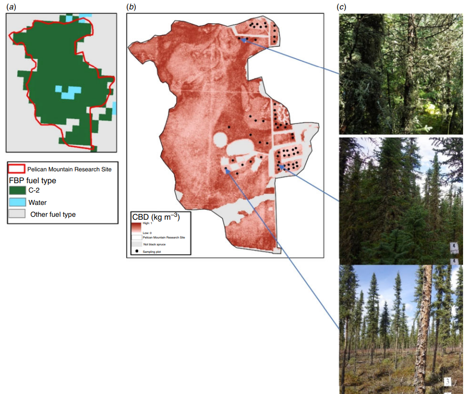
In their recent paper, Cameron, Schroeder and Beverly 2022 used airborne laser scanning (ALS), a remote sensing technology that uses LiDAR (Light Detection and Ranging), to estimate forest attributes relevant to fire behaviour in black spruce (Picea mariana) stands in Alberta, Canada. The five fuel attributes they measured were canopy bulk density, canopy fuel load, stem density, canopy height and canopy base height. Regression models indicated strong statistically significant relationships between ALS data and field measurements of the forest metrics of interest, for all metrics excepting canopy base height, which had a weaker relationship. Below, you can see in Figure (a) The Fire Behaviour Prediction (FBP) fuel type map for the Pelican Mountain study site, which shows the area is almost entirely covered by the C-2 Boreal Spruce fuel type. The ALS-derived fuel attributes in Figure (b) show that canopy bulk density can vary substantially within black spruce stands. Model results also corresponded well with field photos that show the model is accurately detecting areas of high (c, top), intermediate (c, middle) and low (c, bottom) canopy bulk density values (Photographer: Hilary Cameron). |
© 2025 by J. Beverly
Banner photo courtesy Alberta Wildfire - Fire PWF-034 2018
Banner photo courtesy Alberta Wildfire - Fire PWF-034 2018


